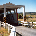
Covered Bridge Loop
This ride is a moderately difficult 16.6 mile loop with a few hard climbs. You will see 4 of Bedford County’s 14 covered bridges along the way as well as some beautiful scenery. To start the ride, take Rt. 220 North out of Bedford to Rt. 56 towards Johnstown. Take Rt. 56 west for about 4 miles to Fishertown County Store (on your left). This is your start and end point. Note:For a 9 bridge loop to take in your car, visit the Covered Bridge page here.
Area: Northwest Bedford Co.
Distance: 16.6 Miles
Difficulty: Moderate
Loops? Yes
Starting GPS coordinates:
40° 7’41.53″N 78°34’52.30″W
